


SoilWaterNow is a project that has the potential to offer near-real-time insights into plant-available water (PAW) for large areas and for the whole soil profile.
The approach utilises diverse data layers and recent advancements in Earth observation and computational capabilities. It provides estimates that can be made available to everyone through freely accessible, national and global geospatial datasets related to soil water balance.
The development of this crop monitoring technology comes from GRDC investment and is headed by Tom Bishop from the University of Sydney’s Precision Agriculture Laboratory, in collaboration with CSIRO, the Australian National University and the Bureau of Meteorology.
Built into this approach are digital soil maps (DSMs). These are used to inform soil properties that reflect vertical water movement in soils. The DSMs can be generated using mapping products under development in a related GRDC investment.
The water balance model can then account for unsaturated flow and infiltration. This innovative water balance model incorporates base inputs such as:
- SILO rainfall data: a Queensland Government database containing continuous daily climate data for Australia from 1889 to present for modelling and research applications;
- the high-resolution MODIS evapotranspiration (ET) product: a NASA project estimating global terrestrial evapotranspiration from Earth’s land surface by using satellite remote sensing data; and
- the DSMs from Soil and Landscape Grid of Australia.
The model can be applied across the country, providing valuable insights into soil moisture conditions.
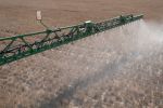
However, for growers who have on-farm data – such as weather stations or on-farm digital soil maps – these can also be used as inputs.
Initial work by the team has quantified improvements in accuracy from using on-farm data (such as weather station data, soil data and moisture probes).
To further improve the modelling, neural networks are used to downscale the MODIS ET product from 500 to 20 metres using Sentinel-2 satellite imagery (see Figure 1). This allows better representation of plant water use across paddocks.
Figure 1. (a) The native MODIS evapotranspiration (ET) product at 500 metres and (b) downscaled ET (20m) in millimetres at CSIRO Boorowa Agricultural Research Station in 2021.
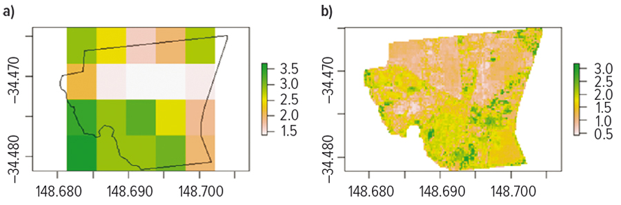
Source: University of Sydney
Product development
In the past year, software engineers at the Sydney Informatics Hub at the University of Sydney have focused on deploying the modelling as a scalable workflow. This will enable companies – and others – specialising in precision agriculture analytics to use the workflow to provide scalable, accurate geospatial data on PAW to their agronomist and grower customers. This includes a number of development steps, including:
- a workflow that directly archives predictions for increased efficiency;
- deploying the workflow on the Google Cloud Platform to test the system’s reliability and the interaction among components;
- establishing strategic data cache protocols to define retention times for different products to enhance data accessibility and system responsiveness; and
- running a cost analysis to ensure the model’s scalability and economic viability.
The workflow is implemented using Nextflow, an open-source platform that allows computational pipelines to be flexibly tested and deployed on local computer resources – high-performance computing or commercial clouds as appropriate. This flexibility ensures the most-suitable deployment to meet industry needs.
Farm input
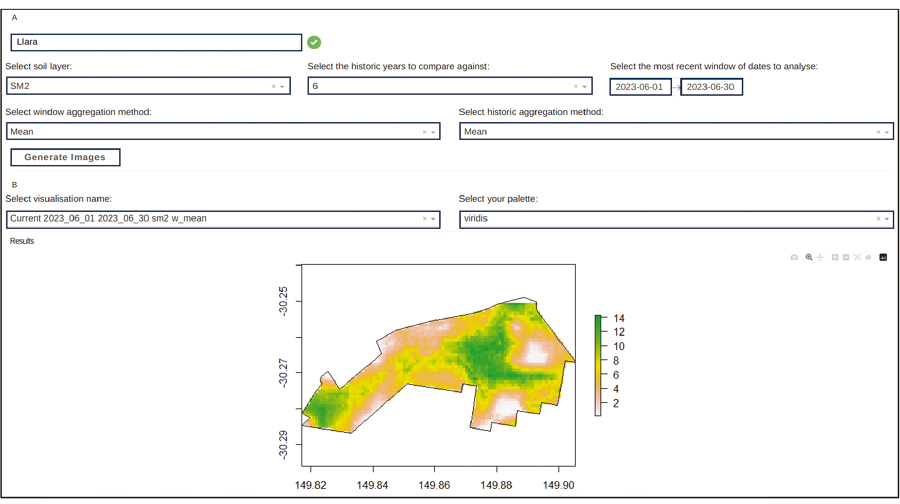
To present and analyse farm soil moisture levels, the ‘SoilWaterBalanceAnalyser’ tool was developed. It compares current data with historical records spanning five years using datacubes, as shown in Figure 2.
Figure 2. A screenshot from ‘SoilWaterBalanceAnalyser’ demonstrates the current soil moisture (mm) level at Llara Farm, Narrabri, for January 2023. This type of information can be provided via an application programming interface to interested parties willing to test model predictions in the 2024 winter crop. Source: University of Sydney
Source: University of Sydney
This tool facilitates comparisons, such as calculating the difference (delta) between the current and historical average moisture levels.
Having access to PAW products through commercial partners will support sowing and fertiliser input decisions, as well as creating a foundational data layer for functions such as:
- measuring PAW capacity;
- automated mid-season nitrogen decisions and other input decisions;
- forecasting yield potential; and
- optimising on-farm logistics into the future.
The outputs of this project are a key piece of the puzzle in digital agronomy and automation more broadly.
The team has built an application programming interface (API) that facilitates the transfer of data between software programs. An input API allows local on-farm data (such as digital soil maps and rainfall records) to be incorporated. This further improves the accuracy of SoilWaterNow predictions.
GRDC and the project team are looking to make that API more widely available to scale up the testing with precision agriculture companies and their agronomist and grower clients in 2024. The intention is to have PAW products deployed on-farm at scale through commercial partners in the 2025 winter crop and beyond.
To be involved and for more information contact niranjan.manikkuacharige@sydney.edu.au.
More information: Thomas Bishop, thomas.bishop@sydney.edu.au