


Key points
- Three projects aim to develop the analytics needed to enable various of on and off-farm data sources to be effectively used in grower-facing decision-support tools
- These tools include: spatial mapping of crop phenology to inform in-season decision-making; rapid assessment of frost damage to reduce income losses; and 'nowcasting' of soil plant-available water to make better tactical and operational decisions throughout a cropping sequence.
GRDC is investing in three crop-monitoring analytics projects in a bid to close the gap between readily available on and off-farm data layers and the analytical tools that enable data-driven decisions.
GRDC manager of transformational technologies Liam Ryan says the approach is ultimately about helping growers optimise input costs, manage risk and improve whole-farm profitability.
The projects - which involve sub-paddock scale mapping of crop phenology, frost damage and soil plant-available water - all have a similar goal.
Fundamentals

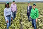
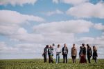
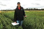
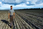
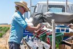
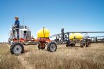
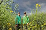
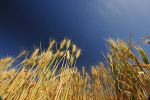
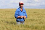
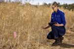
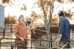
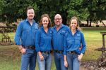
The CropPhen and FrostSENSE projects will develop new analytics approaches to spatially map frost damage and crop phenology on-farm to aid agronomic decision-making by growers and consultants. Photo: David Fulwood
"We are investing in the enabling science to create 'foundational' data layers that can be leveraged by farm management software platforms, ag-tech companies and other third parties who can deliver new and improved decision-making tools for Australian grain growers and consultants," Mr Ryan says.
"Collaboration is key to ensuring growers see profitable applications of digital agriculture on-farm.
"We recognise that commercial companies are often best positioned to develop 'front-end' software solutions for growers - the software tools that are readily seen and used.
"We're investing to solve complex issues in the underpinning science at the 'back-end' because that's a key constraint to growers realising greater profit from on-farm applications of digital agriculture."
Collaboration is key to ensuring growers see profitable applications of digital agriculture on-farm.
The projects aim to build predictive models and foundational data layers that are scientifically robust but also scalable, cost-effective and modular.
"The last piece is important to ensure these tools can be accessed and used with different levels of complexity by multiple third parties so that the benefits can get to as many Australian grain growers as possible," Mr Ryan says.
CropPhen

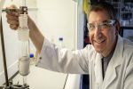
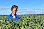
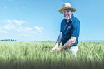
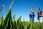
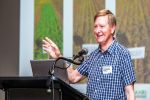
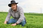
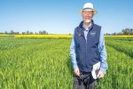
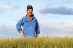
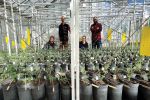
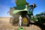
The University of Melbourne's Professor Pablo Zarco-Tejada will combine images from the university's new airborne imaging facilities with ground-based surveys to develop the analytics that drive CropPhen. Photo: Professor Pablo Zarco-Tejada
The CropPhen project aims to develop a software-based tool to remotely map crop type and development stage at the sub-paddock scale and on a weekly basis using satellite imagery.
Spatial and temporal information on crop phenology is a data layer that is key to improving the application of pest, disease and nutrition-based decision-support tools - as well as yield forecasting models.
The project leader, Dr Andries Potgieter from the University of Queensland, has an extensive track record in integrating biophysical and climate modelling tools with satellite imagery for crop area estimates and production forecasts.
The University of Melbourne's Professor Pablo Zarco-Tejada, who is an expert in agricultural applications of remote sensing, will combine images from the university's new airborne imaging facilities with ground-based surveys to help develop the analytics that drive the CropPhen tool.
Dr Kenton Porker from the South Australian Research and Development Institute (SARDI) and Dr Ben Biddulph from the WA Department of Primary Industries and Regional Development will manage core field validation sites, while precision agriculture expert Tim Neale (Data Farming) will contribute to the development of geospatial analytics tools to aid on and off-farm decision-making.
The project team will combine remote sensing, crop simulation modelling, machine learning and field validation datasets to develop an approach that captures data on crop type and developmental stage every five days at a 10-metre spatial resolution using freely available satellite imagery provided by the European Space Agency.
SoilWaterNow
An analytical framework to accurately 'nowcast' soil plant-available water (PAW) is the target of another key GRDC investment in crop monitoring analytics.
The SoilWaterNow project aims to predict PAW in the present (nowcasting) at depth and at the sub-paddock scale using multiple layers of input data from on and off-farm sources.
The project leader, University of Sydney Associate Professor Tom Bishop, says there is a range of input data available to predict PAW, but it is often used disparately.
That means there is no unifying, scalable method to incorporate different types of inputs, such as soil moisture probes, water balance models, remote sensing products and digital soil maps.
"We are developing a framework able to digest multiple data streams to extract their best features in terms of accuracy and spatial and temporal resolution to provide improved predictions of PAW," Professor Bishop says.
"We're taking an agnostic approach that will be future-proof in terms of being able to accommodate the next generation of proximal sensors, remote sensing platforms and water-balance models."
We are strategically investing in the enabling science to create foundational data layers that can be leveraged by farm management software providers and ag-tech companies to deliver new and improved decision-making tools for Australian grain growers and consultants.
The project team includes experts in soil water prediction from the universities of Sydney and Southern Queensland, CSIRO, the Bureau of Meteorology and Australian National University, who will work closely with industry groups such as the Society of Precision Agriculture in Australia.
The project will deliver modular, easily accessible model-code and supporting documentation to enable farm management software providers, agtech companies and other third parties in Australia to leverage the best available science so that growers can have access to innovative products for monitoring, managing and forecasting PAW on-farm.
FrostSENSE

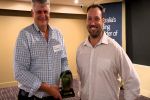
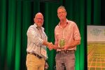
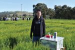
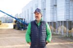
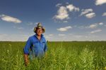
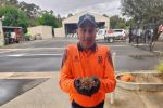
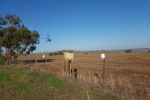
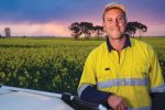
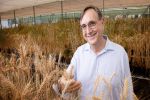
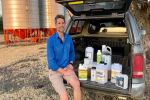
CSIRO's Dr Uday Nidumolu will lead a project to rapidly map the extent of frost and subsequent damage in wheat and barley to help growers make informed management decisions. Photo: Dr Uday Nidumolu
A model to rapidly map the severity and duration of frost and subsequent damage in wheat and barley is being developed in a complementary new investment.
The FrostSENSE project will develop a low-cost method to spatially predict the severity and duration of frost events and the extent of damage following frosts at stem and reproductive phases in wheat and barley.
It will build on a previous co-investment led by CSIRO that developed a modelling approach that uses data from an on-farm weather station and various terrain indices to map the severity and duration of frost events at the sub-paddock scale - at a 30-metre spatial resolution.
The project will be led by CSIRO's Dr Uday Nidumolu and will involve known industry experts Dr Peter Hayman (SARDI) and Mick Faulkner (Agrilink), along with local expertise within the Birchip Cropping Group in Victoria.
The project aims to improve the accuracy of the existing approach and evaluate the benefits of incorporating satellite imagery to map not just the severity and duration of frost events, but the likely extent of damage at the sub-paddock scale.
"This method has the potential to be an important tool for growers in managing frost risk on-farm and mitigating economic losses from frost," Dr Nidumolu says.
GRDC Research Codes UOQ2002-010RTX, UOS2002-001RTX, CSP2002-006RTX
More information: Liam Ryan, 0477 746 414, liam.ryan@grdc.com.au; Dr Andries Potgieter, 07 535 15085, a.potgieter@uq.edu.au; Associate Professor Tom Bishop, 02 8627 1056, thomas.bishop@sydney.edu.au; Dr Uday Nidumolu, 08 8303 8746, uday.nidumolu@csiro.au