


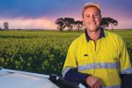

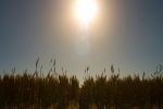

New software designed to identify areas of paddocks affected by soil constraints using satellite data is set for release early next year.
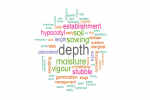
The web-based tool, known as ConstraintID, was developed with University of Queensland and GRDC co-investment following findings that sodicity, salinity, acidity and compaction together are estimated to cost Australian grain growers more than $1.5 billion in lost production every year.
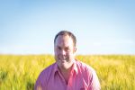
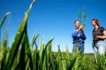
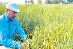
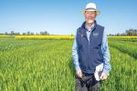
Dr Yash Dang, a senior research fellow at the University of Queensland, says ConstraintID was created to help better understand how crop yields vary within paddocks and how this relates to soil constraints.
“Knowing how and why past crop yields vary across a paddock over multiple seasons can better target soil testing efforts, inform management decisions and lead to improved crop yields in the future,” Dr Dang says.
“Remote-sensing data provides a valuable information source about past crop yields, allowing us to look back through multiple years of yield variation that repeats season after season.”
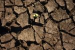
Consistent patterns of yield variation across multiple different seasons might imply the presence of one or more soil constraints such as sodicity, salinity, acidity and compaction, which may have previously gone undetected, Dr Dang says.
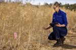
“The essential next step is going into the paddock of interest and carrying out soil tests or looking at the features of the land to determine explanations for crop yield variation,” he says.
The mechanics
Using ConstraintID is as simple as a few clicks on a computer using Google Maps to locate a paddock of interest. The next step is drawing a boundary around the paddock.
Once the paddock boundary has been selected, the tool then searches a database of multi-year remote-sensing data that goes back more than 20 years, collected from earth-observing satellites.
Data for the tool has been compiled and processed across the grain-growing regions of New South Wales and Queensland, using Landsat imagery and image processing and analysis tools provided by the Queensland Department of Environment and Science’s Remote Sensing Centre.
After a minute or so, depending on the size of the paddock, ConstraintID issues a report showing parts of the paddock that have yielded poorly across multiple seasons. The results generated include yield maps for each growing season and the probability of likely soil constraints.
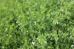
To produce each map, images from close to the time of maximum biomass (usually at or just after flowering) are used to calculate a vegetation index (NDVI) – a measure of plant greenness and crop health – which is highly correlated with final grain yield.
The tool then analyses whether there is enough information to conclude a winter crop was grown in each season. If so, a tick is displayed next to the map. If not, a cross is displayed. Users can then unselect certain years, for example, where the paddock may have been divided into different management zones. Only maps for ticked years will be considered in further analysis.
Dr Dang says data from the ticked years is summarised and a statistical analysis is applied to determine whether there is sufficient evidence that a certain part of the paddock is consistently high or low yielding.
“The tool shows if there are consistent spatial patterns in the data and will compile and present rainfall data and maps of potential constraints for comparison,” he says.
“Between three and five different management zones are created within ConstraintID and these areas can then be investigated by going into the paddock and carrying out a range of soil checks to determine the possible causes for low yield.”
Data sources
Dr Dang says the software tool is based on freely available data sources. These include more than 20 years of stored data from the Landsat series of satellites (at a resolution of 30 by 30 metres) and legacy soil datasets from the Australian Soil Resource Information System (ASRIS).
Dr Dang says legacy soil testing data will be available through ConstraintID to provide some background on the probability that a soil constraint exists; however, this is unlikely to shed much light on within-paddock yield variation.
“Accordingly, there will be an option within the tool to enter soil testing data from the paddock of interest, which will help line up the soil data and the remote-sensing data to better identify the soil constraints likely to be driving within-paddock yield variation,” he says.
“Soil test results may indicate the need to ameliorate the paddock with lime or gypsum, or both if sodicity and acidity are constraining grain yields in the paddock of interest.
“Another outcome might be to decide to plant crops that are more tolerant to the soil constraints discovered.”
The tool might not always provide new insights, Dr Dang says. In those cases, it might just confirm existing knowledge of a paddock.
In other cases, he says, it might reveal consistent patterns in the remote-sensing data that were not already evident. Once ground-truthed, these constraints can be ameliorated or more effectively managed to boost yield in the future.
Data analysis
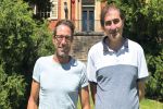
Co-researcher Dr Tom Orton, who works as a geostatistician at the University of Queensland, has developed methods and computer code over the past two years to capture and analyse NDVI and soil data for use in the software tool.
Other research is underway to look at better ways to use remote-sensing data to discriminate between crops and pastures and predict yield. If considered viable, these algorithms will be added to future versions of the tool.
DHM Software engineer David McClymont has worked with Dr Orton to ensure the computer code used in the tool can be converted into the appropriate information technology language for delivery over the internet.
Ideally, Dr Dang says, ConstraintID would be updated each year so the database it draws from contains the latest remote-sensing data for farms in Queensland and NSW.
Hands-on workshops are expected to be held during 2021 to demonstrate how the tool, which is free, can be used to better target soil sampling efforts to identify key soil constraints in paddocks, and the steps needed to overcome them.
GRDC Research Codes UQ00081, UOQ1803-006RTX
More information: Dr Yash Dang, 0427 602 099, y.dang@uq.edu.au