


Key points
- EM and gamma farm maps can be overlaid to make user-friendly soil-type maps to inform management practices
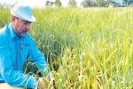
- Ground-truthing of EM and gamma soil maps can be achieved with the use of datasets (soil texture and chemistry) and grower knowledge
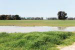
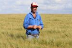
Management of cropping country could be significantly aided by fast and accurate assessment of within-paddock variability and, in particular, the accurate identification of any soil constraints.
This was one of the aims of a five-year GRDC western region investment in subsoil constraints initiated in 2014 using simple paddock and farm-scale maps generated by ground-based geophysics tools. These were to combine electromagnetic (EM) induction and terrestrial gamma radiation maps in a simplified form to assist grower decision-making.
Mapping tools
EM measures the soil's electrical conductivity and the signal is related to water, salt and clay content. The signal can be read from zero to 1.5-metre depth.
Gamma radiometrics measures the natural emission of radioactive isotopes and daughter radionuclides of uranium, potassium and thorium. This signal infers information about the soil mineralogy, soil potassium, gravel and soil depth; it works mostly in the top 0.3m but can extend to 1m.
Typically, EM and gamma tools are used separately and then the measurements are correlated to soil chemical properties such as cation exchange capacity, organic matter, clay percentage and electrical conductivity. The maps generated from this data have proved challenging for growers and advisers to use for practical decision-making.
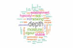
Multiple data layers can generate user-friendly soil zone maps to inform management decisions for different soil types.
The intention of this project was to combine these mapping tools and generate simpler, useable maps.
The research capitalised on previous GRDC investments and precision agriculture projects by overlaying the mapping components on field-based data for soil descriptions, soil chemistry and plant-available water capacity (PAWC) already collected.
The case study sites were spread across the WA wheatbelt and included 16 farms, 29 paddocks (amounting to 2733 hectares) and one whole farm of greater than 20 paddocks (2466ha) and 355 soil sampling points.
Process

Soil data was first assigned to a WA soil type as shown in Table 1.
After the paddocks were mapped with the EM and gamma tools, the EM values were separated into low and high classes and differentiated using red and blue colours (see Figure 1). Gamma counts were separated into three classes (low, medium and high) and correspondingly assigned a dark grey, light grey or yellow colour (see Table 1 and Figure 1).
Figure 1 shows an example map for one of the WA sites. The individual gamma and EM maps are combined to produce a soil zone map (right of Figure 1).
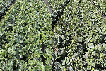
From this map, more productive soil types can be identified and the performance of crops on these good areas can be benchmarked against crops on poorer areas to determine the yield gap using yield maps (Figure 2). Grower knowledge, visual observation and further soil sampling can then identify either the nutrient or soil constraint of the poor zones.
 overlaid on soil zone map to produce a yield gap map (bottom right). SOURCE CSIRO")
FIGURE 2 Yield maps (top left) overlaid on soil zone map to produce a yield gap map (bottom right). Source CSIRO
Once the constraint has been identified, a decision-support tool such as 'Ranking options for amelioration' (ROSA) can be used to assess the economic feasibility of ameliorating the constraints.
Future work using on-the-go sensors to determine clay depth - and then overlaying this additional map - would further add to the power of this approach to improve management, in particular of duplex soils by delving or soil-mixing amelioration strategies.
More information: Dr Yvette Oliver, CSIRO, Yvette.Oliver@csiro.au, 08 9333 6469.