Research project looks at remote and proximal sensing tools to help assess frost damage.
Remote and proximal sensing tools could be used to help growers rapidly identify areas of crop affected by frost and enact an appropriate management plan.
Research conducted as part of the Victorian Grains Innovation Partnership between Agriculture Victoria and GRDC has focused on the use of such tools to identify frost damage and whether these findings hold at paddock and commercial scale.
Agriculture Victoria senior research scientist, Dr James Nuttall, says frost costs Australian dryland growers up to $360 million each year.
"Currently, growers use variety choice, crop choice and time of sowing as part of their management strategy to limit the impact of frost," Dr Nuttall says.
Helping make management decisions
"While not a solution to the problem, a rapid and early detection method for frost-induced damage to crops, using proximal or remote sensing technologies, would allow tactical decision-making for managing frost-affected crops and limiting financial losses," Dr Nuttall says.
"Rapid estimation of frost damage on a spatial basis could translate to timely management decisions, such as zoning for crops to be cut for hay, prioritising further crop inputs, altered grain marketing strategies and improved planning of harvest logistics."
Agriculture Victoria remote sensing scientist, Dr Eileen Perry, says using natural field variation in frost at Kewell, Victoria, in 2015, found fluorescence indices such as the FLAV index - which is proportional to the flavanol content of leaf and fruit and essential for pigments - correlated well with frost damage in wheat.
In subsequent years, artificial frost damage was imposed on wheat in trial plots using mobile chilling chambers to provide a backdrop of field wheat differentially affected by cold load.
"That enabled us to identify potential remote sensing indices targeting frost damage using hand-held sensors," Dr Perry says.
"For artificial frosts, the wheat response was a two per cent reduction in grain number and yield per hour below 0°C."
"From that work, we found the reflectance indices photochemical reflectance index (PRI) and normalised difference vegetation index (NDVI) correlated with cold load, while fluorescence indices FRF_G and SFR_G correlated with cold load".
Multi-spectral camera survey
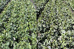
Artificial frost effects are applied to wheat using field chambers in Horsham. Photo: Agriculture Victoria
To field-validate these findings, in 2018, six commercial wheat paddocks near Jung, Victoria, were surveyed using an Airphen multi-spectral camera at 2750 metres above the ground.
"This work found significant rolling frosts with intra-paddock variation of time spent below 0°C, where time spent below 0°C correlated well with variation in grain yield across the majority of paddocks surveyed," Dr Nuttall says.
"We also found PRI correlated well with grain yield."
Dr Nuttall says these results indicate proximal and remote sensing tools do have practical application to industry, such as rapid in-season detection of frost damage.
"These tools may support targeted management, thus limiting financial losses due to frost," he says.
He says scanning for frost damage across paddocks may be practical if several growers contract an aircraft equipped with a multi-spectral camera to scan multiple farms, making the process fast and affordable.
These tools may support targeted management, thus limiting financial losses due to frost.
"Another idea is to determine whether active fluorescence has a role in practical proximal sensing applications such as rapid paddock scouting for frost damage," Dr Nuttall says.
"There could be potential to develop proximal sensing technologies for on-farm quality segregation of grain to enhance the grain's export or market value."
The Victorian Grains Innovation Partnership between Agriculture Victoria and the GRDC aims to increase the profitability of southern grain growers through world-class research.
More information: Dr James Nuttall, Agriculture Victoria, 0409 423 541, james.nuttall@agriculture.vic.gov.au


