


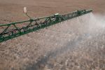


Every few days, satellites are generating a new colour-coded picture of Australia with Normalised Difference Vegetation Index (NDVI) images, and growers are increasingly accessing these to improve their understanding of what is happening in paddocks.
Working with clients, businesses such as Swan Hill-based AGRIvision Consultants are also increasingly using these images.
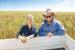
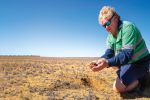
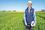
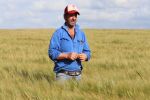
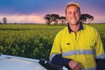
The company's manger, Kent Wooding, says while they won't replace ground-based data collection, they can assist in growers' decision-making.
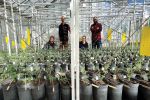
AGRIvision employs 21 agronomists throughout the Mallee, North Central and Wimmera districts, and has been using NDVI images through the DataFarming platform since they became available early in 2018.
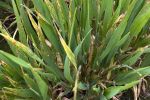
"NDVI isn't going to replace the ground-truthing that still needs to take place with the grower, but it does point out weed hotspots, or areas which might have had severe frost damage - or escaped frost damage," says Mr Wooding.
"That's the kind of information that will prompt a grower to go into a particular spot in the paddock and make a management decision.
It doesn't replace the need to go into the paddock, but makes the exercise more efficient.
NDVI isn't going to replace the ground-truthing that still needs to take place with the grower, but it does point out weed hotspots, or areas which might have had severe frost damage - or escaped frost damage.
While NDVI images can be obtained at little or no cost through online platforms like DataFarming, Mr Wooding says their biggest 'plus' is their ability to add to the guides and indicators thrown up by ground-based technology, namely EM38 and yield mapping.
Wimmera experience
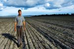
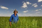
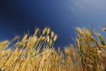
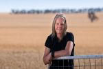
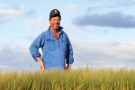
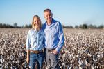
Justin Ruwoldt is part of the Glenvale Farms partnership at Kewell in the Wimmera, an AGRIvision client which grows barley, canola, lentils and wheat.
He uses DataFarming's NDVI images to pick up anomalies in paddocks.
"I'd seen it through social media, and its value to us is another analytical tool in the toolkit," he says.
Mr Ruwoldt says its benefit is that it can add an aerial perspective to a development noted from the ground, such as reduced or increased biomass, and it can indicate anomalies within the paddock which can then be ground-truthed.
"You might find the NDVI map shows up a low biomass in your canola on your lighter country, which germinated early, and should be performing better," he says.
"You can take that image out into the paddock on your iPad, and see exactly where the problem is.
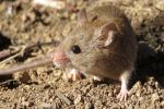
"You might find it could be Red legged earth mite or lucerne flea that's affecting that part of the crop."
Mr Ruwoldt uses Glenvale Farms' own network of moisture probes, and yield maps, to monitor paddocks' needs, and says NDVI imaging may have a role to play in variable-rate applications of inputs like gypsum.
You can take that image out into the paddock on your iPad, and see exactly where the problem is.
"There's no revolution around the corner. No-till and controlled traffic are the big ones that have changed how ag rolls, but NDVI is part of that one-per-cent stuff that can all add up," he says.
"If it allows you to get on to an insect infestation or mice damage early, or hold back a nitrogen spend of $30 or $40 a hectare because your crop has enough nutrients to support that biomass, you've increased your bottom line."
Mr Ruwoldt says paddock history, as well as the current season, needs to be considered when interpreting NDVI images.
"What NDVI gives you is a beautiful colourful map," he says.
"It's all up to interpretation as to what you do with it."
Under the clouds
Mr Wooding says the main weakness of satellite images is their reliance on cloud-free atmospheres, which are atypical during the high-rainfall months in the winter-crop growing period.
"You could go a month without having a cloud-free image; that's their Achilles heel," he says.
DataFarming managing director Tim Neale says the platform offers some way around the clouds, as images come with a figure to indicate the percentage of cover.
"If it's less than 100 per cent, some or all of the paddocks a user is interested in might not be obscured by cloud, so it's worth zooming in and having a look," Mr Neale says.
Hay, grain and pulses
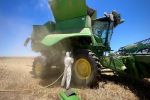
Limited moisture throughout the 2018 growing season, compounded by heavy frost, pushed some growers into having to cut grain crops for hay, and Mr Wooding says NDVI images were helpful in ensuring crops with better yield potential made it through to harvest.
"The grower and the agronomist generally know where the good and bad areas of the crop are, the NDVI images help better define where the cut zones need to be," he says.
"It helped us go to zones within paddocks and pick up where the differences in yield potential were - right across the Mallee and into the Northern Wimmera."
AGRIvision Consultants manager Kent Wooding says the grower and the agronomist generally know where the good and bad areas of the crop are, the NDVI images help better define where the cut zones need to be.
AGRIvision agronomist Tom Batters says he has also been using NDVI images to help decide when to desiccate pulses in preparation for harvest.
"You can calculate the area of ripe versus unripe pods, and decide if more time is needed before desiccation, or if the unripe area is too small to worry about when compared with the rest of the paddock," he says.
Expanding use
Mr Wooding says the AGRIvision team is constantly coming up with new uses for NDVI in terms of fine-tuning the guides for variable-rate applications on inputs like fertiliser, lime and gypsum.
"We used a gypsum map from previous years when lentils were grown in sandy clay loams, and it helped us pick out hard-setting sodic zones," he says.
"We had to ground-truth it, which we did with the grower because he knew where the zones were.
"NDVI clearly defined the zones so we could put an amelioration strategy into action."
Mr Wooding says interest in NDVI is gathering pace.
"Every week, every month, we're finding new uses for imagery," he says.
Ground-floor entry
Mr Wooding says NDVI images on platforms like DataFarming are helping growers and consultants to engage with using imagery as an overlay to other pools of data.
"We initially looked at the NDVI images out of interest, knowing that growers weren't prepared to pay for them because, as an industry, we were struggling to come to terms articulating how growers will make money out of the imagery," he says.
Mr Wooding says the worth of NDVI images increases when it used with other data layers, and software to fine-tune variable-rate applications.
"Data from NDVI images, EM38 and yield maps, requires manipulation through programs and platforms to get it into a machine," he says.
"Most clients are interested in using NDVI, but it's the ones with the capability in terms of the machinery and equipment that can translate the information that are using it.
"It is about turning data into actions.
"It's about getting better and making an informed decision.
"They're looking for things that can make them money, and this is one of them."
More information: Kent Wooding, 0427 044 748, kent.wooding@agrivision.net.au; Tim Neale, 0409 634 006, insights@datafarming.com.au