


Key points
- Ben Boughton started the web-based platform Satamap for viewing and analysing satellite imagery in 2014, before selling it to PCT Agcloud three years ago
- Ben uses satellite data to help make decisions on urea applications, to check on spray drift impacts, hail damage, machinery mishaps and waterlogging, to create yield maps and to assist harvest timing
- Ben’s starting point was his GRDC-supported Nuffield Australia tour nearly 10 years ago
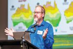
When Ben Boughton returned from his GRDC-supported Nuffield Australia tour nearly 10 years ago, he thought he would end up starting a company that used unmanned aerial vehicles (UAVs, or drones) to help growers such as himself make on-farm decisions.
He was half right: he did end up starting a company that used remote sensing in decision-making. However, he decided on satellite imagery for data collection.
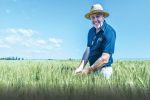
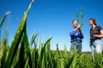
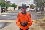
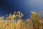
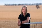
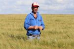
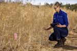
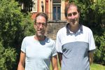
Ben – who grows wheat, barley, chickpeas and sorghum on 2500 hectares near Moree, New South Wales, with his wife Olivia, their three young boys, and Ben’s parents Randall and Donna – started Satamap, a web-based platform for viewing and analysing satellite imagery, in 2014. It was sold to PCT Agcloud three years ago, and Ben worked with the company until the end of last year.
Although now out of the business, Ben says his adventure with remote sensing, data and technology is ongoing. “It is a journey I was able to build a business around. Satamap’s aim was to increase adoption. The information was out there, but I wanted to get it in the hands of agronomists and growers like myself.”
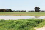
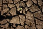
These days he uses satellite imagery on-farm to help make decisions on urea applications, to check on spray drift impacts, hail damage, machinery mishaps and waterlogging, as well as create yield maps and assist with harvest timing.
“Imagery accurately tells you the plant productivity variation throughout a paddock at a certain point in time. In-season, this is great for monitoring paddocks for anomalies, understanding responses to trials or crop damage.”
At season’s end, this imagery can help determine harvest timing and understand yield variability. “As many people know, biomass doesn’t always equate to grain yield, but it comes closer than many think if end-of-season frost or heatwaves are not an issue. I like to think of crop biomass at flowering as a yield potential map. The plants still need to build the biomass that set the grain, which takes nutrition and moisture.”
Ben says that although much technology now exists to collect data and address variability, there is often a missing piece. “We can have all this soil data and yield data, but we have to work out how to use it and get tangible outcomes. Satellite imagery can show us which areas are performing well, but we still need to ask why, and then be able to address that.”
It is an area he wanted to address when he embarked on his Nuffield Australia scholarship in 2014. At the time, he was keen on finding out more about UAVs and remote sensing, and their potential for helping with on-farm decisions. He spent a lot of his time in the US talking to fellow growers and start-up entrepreneurs.
Soon after his return to Australia, his interest in remote sensing turned to satellite imagery. “There were a lot of reasons for this. One of them was time. Drones are a good idea, but the problem for time-poor growers is the time it takes to operate one. It is time away from other jobs.”
Around this time, the satellite industry was expanding, creating more opportunities. “Back when I did my Nuffield, Landsat 8 (an American satellite launched in 2013) was free and open but it only captured images every 16 days, which is not enough.
“Also, the higher-resolution images were expensive. We were competing against everyone else for the data, such as governments and militaries. That has changed and we are going into a period where there are more satellites in space, more dates available, and it’s not so expensive.
“For me, monitoring crops with satellite imagery has proved much more reliable, repeatable and less time-consuming. It was evident very early on that ‘bang for buck’ was with the satellites.”
Ben believes this will continue. “I find that for broadacre farming, there is a lot more value coming out of the satellite space. We are going into a period where there are more satellites in space, more dates available for images and more ways to use that data.”
Technology crossover
Australian growers are entering an exciting period of technological advances with seemingly no limits on collecting data or putting it to use on-farm, he says.
“Technology originally intended for other purposes is spilling over and is looking for a home in agriculture.
“For example, the artificial intelligence hardware used in some of the new green-on-green type camera sprayers may not be cost-effective if it was specifically developed just for the optical sprayer. But they were developed for other industries first and now mass-produced (by Nvidia Jetson Nano).
“Likewise, all the sensors used in any sort of Internet of Things device or agricultural drone was probably made cost-effective by the mass development of modern mobile phones.
“Also, simply, many farms – like most businesses – now rely heavily upon tablets and smartphones for data entry, communication, safety processes and so on.”
He encourages others to try options they see merit in, but to take a cautious approach. “For example, big data doesn’t always equal good data and automating chemical or fertility decisions may not always deliver as promised.”
For example, he says that while he has dabbled with variable-rated urea in the past, he has not stuck with it. “We usually only pre-apply urea and the risk was in not applying full rates everywhere and taking a yield hit in the good seasons, as some soil types surprise you. We did revisit this decision this year with sky-high fertiliser prices, but still decided the risk of taking a yield hit was too high.”
However, other on-farm technological advances are playing a key part in how the Boughtons tackle weeds.
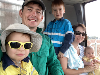
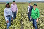
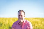
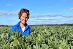
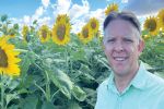
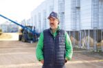
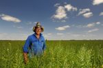
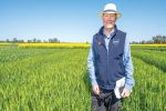
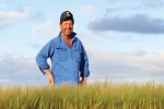
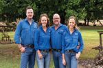
Moree grower Ben Boughton farms with his wife Olivia and their three young boys. Supplied: Ben Boughton
Ben says that around the time he returned from studying a Bachelor of Agriculture at the University of Queensland, Gatton, the family enterprise was moving away from glyphosate.
“When I came back to the farm, we were moving from the easy days of no-till and glyphosate-dominated fallow control to requiring a double knock to control weeds that had developed resistance and prevent further problems.
“Double knock is not only expensive but time-consuming, especially because the second round requires higher water rates and performs better when applied at night.”
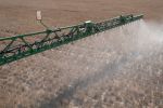
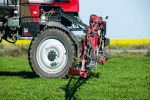
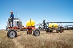
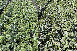
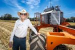
This led to a rethink and the purchase a small, second-hand optical spot sprayer. “It saved in chemicals but was slow going at only 24 metres wide and was limited to slower application speeds.”
Optical spot sprayers use near-infrared sensors mounted on a spray boom to ‘see’ weeds by detecting active chlorophyll. A message is sent to the nozzles, which then spray the weed. This differs from the conventional blanket approach, where the whole paddock is sprayed.
A 36m WEEDit soon followed. “The extra width and more-accurate cameras have made a huge difference,” Ben says. “We usually do a blanket knockdown after harvest and then spray single passes with the WEEDit until a final blanket spray before planting.”
However, a challenge continues to be more resistance to in-crop grass weed control, particularly with black oats and phalaris. “We will need to begin to borrow some tools from growers in the west and south that have been long dealing with the ryegrass issues.”
But he sees optical cameras currently on sprayers evolving to more-complex vision systems. “They will one day soon be a solid solution to controlling weeds in crop.”
More information: Ben Boughton, 0428 548 688, bboughton@gmail.com