


Key points
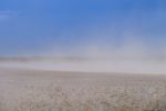
- A rare third La Niña event is underway, signalling above-average spring and early summer rainfall in northern and eastern Australia
- Although unusual, triple events have occurred before La Niña is one of three phases of the El Niño–Southern Oscillation (ENSO)
- The bureau’s rainfall outlook shows wet conditions persisting, reflecting La Niña and several other wetting climate drivers
Although La Niña is in the spotlight right now with a rare three-in-a-row event underway, the Bureau of Meteorology’s (BOM’s) wet outlooks for the rest of the year reflect not only La Niña, but also a number of climate drivers. These include a negative Indian Ocean Dipole (IOD), a positive Southern Annular Mode (SAM), and warm ocean waters around Australia.
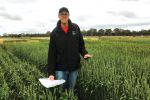
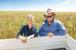
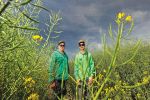
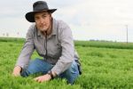
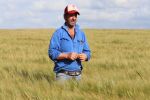
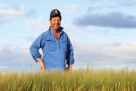
BOM’s extended prediction technical lead, Dr Andrew Watkins, says La Niña conditions increase the chance of above-average spring and summer rainfall in northern and eastern Australia. Its opposite is El Niño, which signals dry conditions.
La Niña is one of three phases of the El Niño–Southern Oscillation (ENSO). ENSO is a recurring climate pattern where the water temperature in the central and eastern tropical Pacific oceans changes and these changes influence the probability of rainfall amount over the forecast period.
Despite working in long-range forecasting at the bureau for more than 20 years, this is the first time Dr Watkins has turned the ENSO Outlook dial from alert to La Niña three times in as many years.
“Back-to-back events, like in 2010 and 2011, are more common, whereas a triple La Niña is unusual,” Dr Watkins says. “We had one from 1998 to 2001, from 1973 to 1976, and from 1954 to 1957, although the American climatologists dispute this one. And now we’re in for another three-peaked event. We’ve had 2021 and 2022 and we’re rolling into 2023.”
Akin to the Dorothea Mackellar poem, Dr Watkins says Australia’s weather does tend to move from drought to flooding rain.
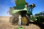
Quite often, we go from very dry conditions to heavy rain, which can be a big relief for agriculture. We often don’t get widespread flooding from the first La Niña year after drought.
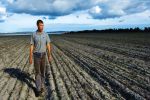
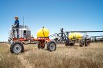
“But once you wet-up the landscape, the second La Niña year tends to be a more difficult one often causing flooding. This is what we’re seeing now and that is hard. It is harder to get onto paddocks to plant, spray or harvest.
“There is a greater impact, simply because when the rains do come, the soils across the landscapes are already wet which reduces infiltration rates and increases run-off. There’s not a lot of room for the water to go. So, the second years of these multi-year events always appear to be a lot more difficult than the first.”
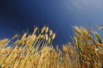
Models predict this third La Niña event may peak in the spring, returning to neutral conditions early in 2023. This decline is earlier than normal, as La Niña events typically peak in the summer and end in the autumn. But given the wet landscape, any rainfall over summer can potentially cause more waterlogging or flooding.
Looking ahead, Dr Watkins says an El Niño is more likely following a La Niña year. “It is like you’ve given the Pacific Ocean a great big shock and sometimes it can bounce back just a little too far and flip over to an El Niño. That is not the case every time, but around half the time this occurs the following year.”
Climate drivers
Dr Watkins explains that BOM’s outlook incorporates different climate drivers.
“Models run by these supercomputers essentially look at the physics of how the atmosphere, the ocean, the land and the ice interact and the mathematics of that interaction into the future.
“These models have basically been saying it is going to be wet. Models from eight key centres around the world are all saying the same thing.
“These outlooks are really critical because they incorporate all the climate drivers. They’re not just saying it’s another La Niña year. They bring all these factors together.”
These drivers include ENSO, the IOD, the SAM and even the polar vortex high above Antarctica.
El Niño–Southern Oscillation
The bureau bases its ENSO alerts on four key factors:
- the current sea surface temperatures in the tropical Pacific;
- trade winds;
- the Southern Oscillation Index (SOI); and
- climate model forecasts for how these factors may change.
All these factors are now at La Niña levels after the tropical Pacific cooled further during August. Atmospheric indicators including the SOI, trade wind strength and equatorial cloudiness are all also displaying patterns typical of a La Niña event.
Indian Ocean Dipole
The IOD is the difference in sea surface temperatures between the western and eastern tropical Indian oceans.
A negative phase typically sees above-average winter to spring rainfall in Australia, while a positive phase brings drier-than-average seasons. Dr Watkins says a negative IOD is underway. “We have these really warm waters off north-western Australia that are drawing moisture in.”
All surveyed climate models agree that negative IOD conditions are likely to continue into late spring. When a La Niña and a negative phase of the Indian Ocean Dipole coincide, it further increases the likelihood of above-average rainfall over Australia, particularly in the eastern half of the continent.
Southern Annular Mode
The SAM is a climate driver that can influence rainfall and temperature in Australia. It refers to a non-seasonal, north–south shift in rain-bearing westerly winds and weather systems in the Southern Ocean.
The SAM has three phases: neutral, positive and negative. It is in a positive phase and is likely to stay that way until December, bringing a wetting influence for parts of eastern New South Wales and far-eastern Victoria, but a drying influence for western Tasmania.
The polar vortex (winds spinning clockwise around the South Pole) in the stratosphere over Antarctica can help push SAM even further north or south.
Recent research via a GRDC-invested project called ‘Forewarned is Forearmed’ delved more into this stratosphere impact.
In 2019, that work found warming of the stratosphere over Antarctica could lead to a slowing-down of the polar vortex and a negative SAM, leading to hotter and drier conditions and more fire weather in parts of eastern Australia, Dr Watkins says.
“It was prophetic work because it was just before the fires. But, basically, that work said that there are links with our climate. A warming of the stratosphere over Antarctica equals warm conditions in eastern Australia.
“This year the opposite may be occurring, with a strong polar vortex helping push the SAM into positive territory, and with it cooler and wetter conditions in parts of southern Queensland, NSW and eastern Victoria.”
GRDC and BOM have been working together for the past five years on the ‘Forewarned is Forearmed’ project. This work aims to provide more access to extreme weather and climate forecasts for the grains industry.
More information: Dr Andrew Watkins, andrew.watkins@bom.gov.au; or visit BOM's website.