
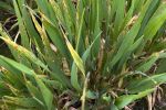


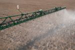


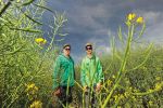

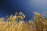


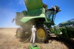
Windrowing canola prior to harvest is a common practice throughout Australia. However, research has shown that mistiming windrowing can cause yield losses of up to 100 kilograms per hectare per day.
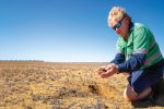
Optimum windrow timing is typically determined by walking through crops, hand sampling and subjectively measuring seed colour change. It can be difficult to pinpoint the correct timing for optimum yield due to the speed at which seed colour can change, particularly on a commercial scale across paddocks with variable soil types, aspect and topography.
Remote-sensing methods could be a feasible alternative to hand sampling and could more reliably assess optimal timing for windrowing at the field scale.
A joint investment between the New South Wales Department of Primary Industries (DPI) and GRDC under the Grains Agronomy and Pathology Partnership (GAPP) is supporting a collaborative project with the University of New England Applied Agricultural Remote Sensing Centre to study this.
The project, ‘Improving canola harvest management decisions with remote sensing’, is investigating the accuracy of satellite and drone-based multispectral imagery sensing for better prediction of canola maturity and, therefore, the timing for optimal windrowing (and desiccation).
The project builds on canola harvesting research findings from the GRDC-supported NSW DPI and CSIRO project ‘Optimised Canola Profitability’, together with the drone-based pilot research project ‘Determining canola physiological maturity with remote sensing’. This project demonstrated the potential for multispectral imagery to assess physiological maturity in canola.
Further investigation using low-cost/freely available satellite imagery is now required to bring this technology closer to large-scale implementation and enable the technology to be more affordable and accessible.
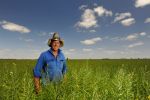
Due to the highly variable nature of Australia’s agricultural soils, combined with differing paddock histories and the wide range of cultivars grown, the maturity of canola crops often varies significantly between and within commercial paddocks.
The proposed remote-sensing approach has the potential to aid canola growers and advisers with optimum canola windrow timing decisions by:
- identifying which paddocks will reach optimum windrow timing first;
- allowing the informed scheduling for paddock windrowing;
- identifying in-crop maturity variability to guide optimum windrowing timing;
- guiding manual-based crop maturity assessment to ensure representative areas are assessed; and
- allowing the centre of paddocks to be assessed for maturity, which are often inaccessible in high-biomass crops.
Two field experiments were established in the 2021 season, with several common commercial cultivars being examined across differing environments. With only a 12-month investment on this topic, this project aims to assess the potential of the technology’s application and determine the requirement for further research. Results will be available by June 2022.
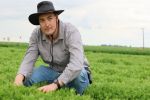
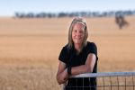
More information: Mathew Dunn, 0447 164 776, mathew.dunn@dpi.nsw.gov.au