


High-tech research is developing a three-dimensional (3D) mapping strategy to better understand the dynamics and location of constraints to crop production that lurk in the depths of the soil profile.
This is the focus of research led by Agriculture Victoria senior scientist Professor Roger Armstrong as part of the Victorian Grains Innovation Partnership (VGIP) with co-investment from GRDC and Agriculture Victoria.
The research effort, drawing expertise from a disciplinary diverse team of scientists, technicians and PhD students, has the potential to transform the way growers assess and, ultimately, tackle the perennial problem of soil-based crop constraints.
Soil constraints, particularly those in the subsoil, are generally difficult to gauge since the composition of the soil profile underlying cropping areas is often highly variable and hidden from view beneath the paddock surface.
Many growers have knowledge of how soils near the paddock surface vary across cropping areas, but variability in deeper soil layers can be a mystery.
But now, the research has demonstrated the potential to combine soil sensor technologies to 3D-map the location and severity of multiple soil constraints at a paddock scale on western Victorian farms.
The resulting soil maps were overlaid with maps delineating ‘above-ground’ crop growth rates, which were developed using a range of crop sensor technologies.
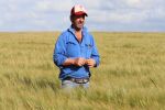
“To date, we have mapped four farmers’ paddocks using the new sensing techniques,” Professor Armstrong says.
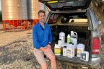
The test paddocks are located in the state’s medium-rainfall zone at Nurcoung, Nurrabiel and Wallup and in the high-rainfall zone at Wickcliffe. Commercial crops grown in these paddocks included wheat, barley, faba beans, canola and subclover.
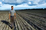
Soil mapping
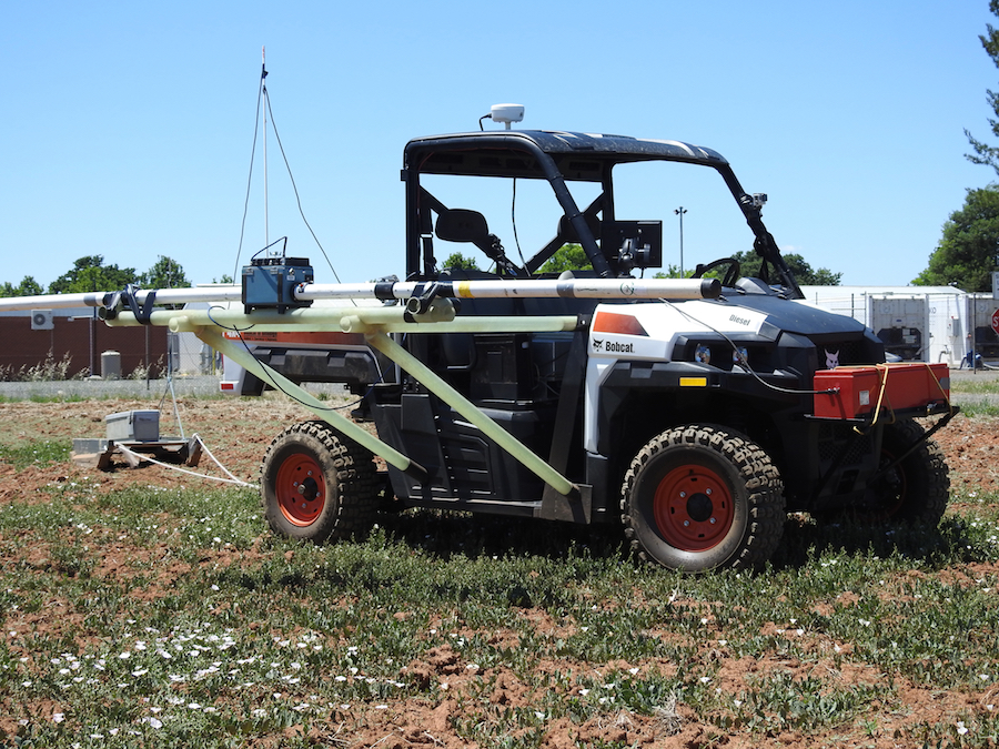
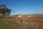
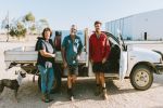
All-terrain vehicle fitted with EM38 and radiometric sensor technologies for mapping the soil profile. Photo: Agriculture Victoria
Professor Armstrong says the soil mapping has mainly relied on two sensor technologies: EM38 or electromagnetic induction mapping, and radiometric gamma ray spectrometry.
For instance, a vehicle-towed EM38 sensor was used to measure soil electrical conductivity in two depth ranges. This EM38 data helps build a spatial picture of soil variability across paddocks since electrical conductivity is influenced by soil texture, particularly clay content, as well as salinity and moisture.
In addition to EM38 mapping, Agriculture Victoria scientists have also road-tested radiometrics, which is a mapping tool routinely used by geologists and geophysicists to detect changes in rock composition and type.
Applying this radiometric technology, a spectrometer instrument was used to measure natural radiation in the soil – specifically the spatial distribution of three radioactive elements: potassium, thorium and uranium.
The abundance of these elements is measured based on the gamma rays they produce. Each gamma ray is characteristic of the element it came from, providing the distinctive clues needed to map variation in soil types beneath the paddock surface.
However, the research team has now expanded the scope of the 3D mapping strategy to include a third sensor technology: ground-penetrating radar (GPR).
GPR is a geophysical sensor that uses ‘radar pulses’ or electromagnetic radiation in the microwave band of the radio spectrum. Theoretically, its capacity to detect signals reflected from soil subsurface structures could be used to gauge changes in soil composition as part of 3D soil mapping.
Professor Armstrong says “novel application” of GPR sensing technology to grain cropping is being assessed for its aptitude to detect the depth of different soil horizons.
For instance, GPR can determine the depth of subsurface layers, such as the ‘B horizon’ which often contains sodic soils. It also has the potential to distinguish soils with uniform high clay content from texture-contrast soils, such as sand over clay.
Such information could add a new dimension to paddock mapping because GPR data can be used to construct 3D images of the soil profile.
Representations of soil data as horizontal slices of the profile, – so called ‘depth slices’ – are extensively used in archaeology to detect cultural activity based on horizontal soil patterns.
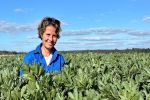
Constraint-performance link
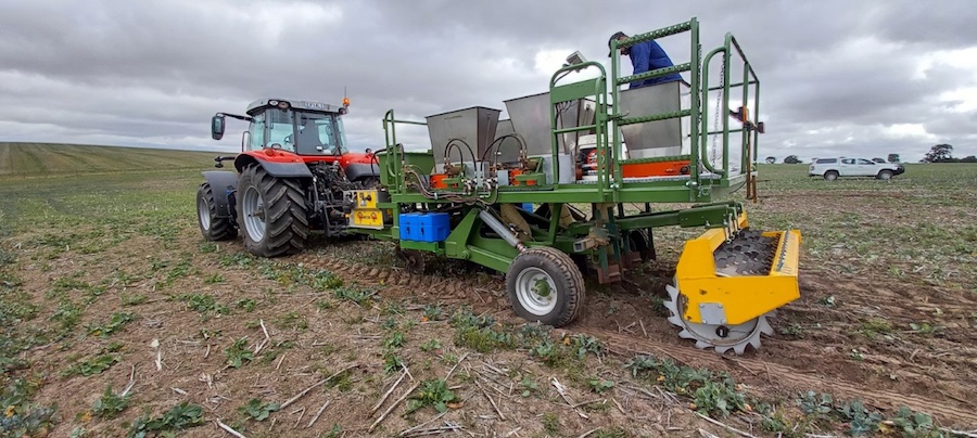
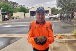
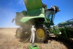
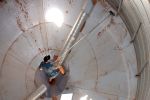
Researchers apply chicken manure and gypsum to the subsoil in a test paddock at Wickcliffe, Victoria, as part of trials examining different soil amelioration approaches in March 2021. Photo: Daniel Hendrie, Agriculture Victoria
Complementing these new approaches to soil mapping are novel methods for measuring above-ground crop growth and water-use efficiency, which are also presented as maps.
The paddock scale maps of crop growth were developed with multispectral imaging sensors, using both ground-based and satellite imagery.
These multispectral technologies included normalised difference vegetation index (NDVI) and normalised difference red edge (NDRE) imaging.
Combining the soil and crop-focused maps “effectively links the 3D spatial arrangement of soil constraints to crop performance”, Professor Armstrong says.
“Together, the two types of mapping have generated multi-layered data sets, analysis of which can help identify the main soil constraints influencing the productivity of different crop types.
“It is remarkable how well the multispectral crop sensing data, especially initial NDVI measurements showing variation in crop growth, were matched to the variation in soil types across those test paddocks.”
The link between soil constraints and crop performance has the potential to guide and prioritise on-farm soil amelioration, reducing the high upfront cost of soil remediation, particularly earthworks.
“Developing the ability for growers to ameliorate soils targeting constraints in paddock areas where the biggest returns are likely was a key objective.”
Chasing this objective, scientists are examining the effects of different soil amelioration approaches, guided by the 3D mapping, in the Victorian test paddocks this season.
“Soil amelioration may not provide cropping benefits in every year because of the way rainfall and other seasonal conditions interact with the soil,” he says.
Computer modelling and machine learning is another component of the research that aims to assess the impact of different soil constraints on crop production in variable seasonal conditions, drawing on a 60-year sequence of weather data.
The modelling results will help predict the biological and economic returns from different soil amelioration approaches.
More information: Roger Armstrong, roger.armstrong@agriculture.vic.gov.au